BEACHES , ISLANDS , HILLS ATTRACTION IN TURKIYE

GOCEK BEACH
The main island beach is reachable by water taxi from the marina within around 15 minutes. The water taxi service is available once every hour and leaves from the pontoon next to the Marina Office.
The beach is enclosed on both side by pine covered slopes, take a swim in the crystal clear waters or relax under the pine trees. There is a cafe, bar, changing area, showers, toilet facilities, sun loungers and parasols for hire.
Once on the island set up a tab at the bar, giving the patron your name, and they will note your boat fare, sun lounger rental and any drinks and food against your name which you can settle before leaving. The last boat returns around 6pm
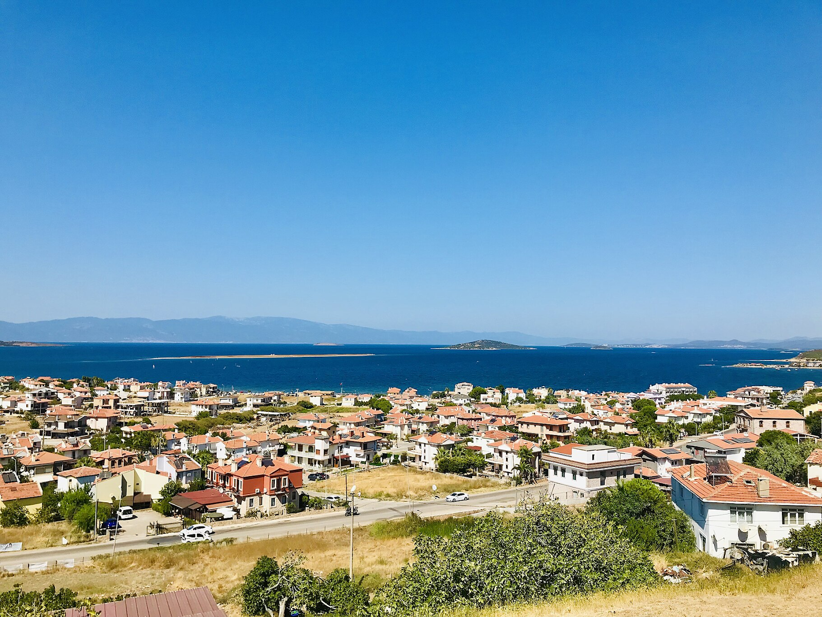
ALIBEY ISLAND
Archaeological excavations at Alibey Island indicate that there were settlements in the area in the Early and Late Bronze Ages and in the Iron Age. Following the Ionic Migration, Aeolian tribes settled on Cunda and other islands. Traces of human settlements have led scholars to the opinion that the most prominent islands of the archipelago were Maden Island (Pordeselene), Çıplak Island (Chalkys), and Cunda (Nesos) Island. The archaeological evidence also shows that Nesos maintained its importance during the Roman and Byzantine eras. The island lost its position during the Middle Age because of the threat pirates´ raids. The threat receded towards the end of the Middle Age, and the development of the island resumed. The famous geographer and cartographer Piri Reis described the islands as the "Yunt Islands" in his Book of Navigation (Kitab-ı Bahriye, 1521) and referred to Cunda by the same name. According to the records of the Ottoman State, the name was officially registered as Yunda, although the name used in day to day speech became "Cunda". Researchers refer to Cunda in the 18th and 19th centuries as a rich settlement independent of Ayvalık, and an urban island in the Mediterranean. In the 19th century immigration from Crete and Lesbos islands helped preserve the unique culture and physical heritage of the island. The name of the island was changed from "Cunda" to "Alibey" as a tribute to Ali Çetinkaya, who, as commander of the 172nd Regiment during the first days of the War of Liberation, organised the defence of Ayvalık.
Reaching Alibey Island from Ayvalık, either by sea or by road brings visitors to the peace and tranquillity of the historic island sanctuary. Churches and monasteries dot the island. The Taxiarchis Church is the largest of the island´s churches. The church´s architecture is still impressive, and its great bell is on display at the Museum of Bergama.
The natural beauty and cultural heritage of Cunda Island are cherished and assiduously maintained by its people, and make the island a major draw for visitors. The higher parts of the island provide many vintage points overlooking narrow sounds, little islands and enchanting coves along the intricate, lace-like shore.
Visitors should enjoy fresh seafood and vegetables in the island´s restaurants, especially the popular fried sprat (papalina) dish, fresh herbs and vegetables cooked in olive oil, and the wide selection of starters (meze). Having a dinner in one of the traditional or modern restaurants with an outstanding view is unforgettable.
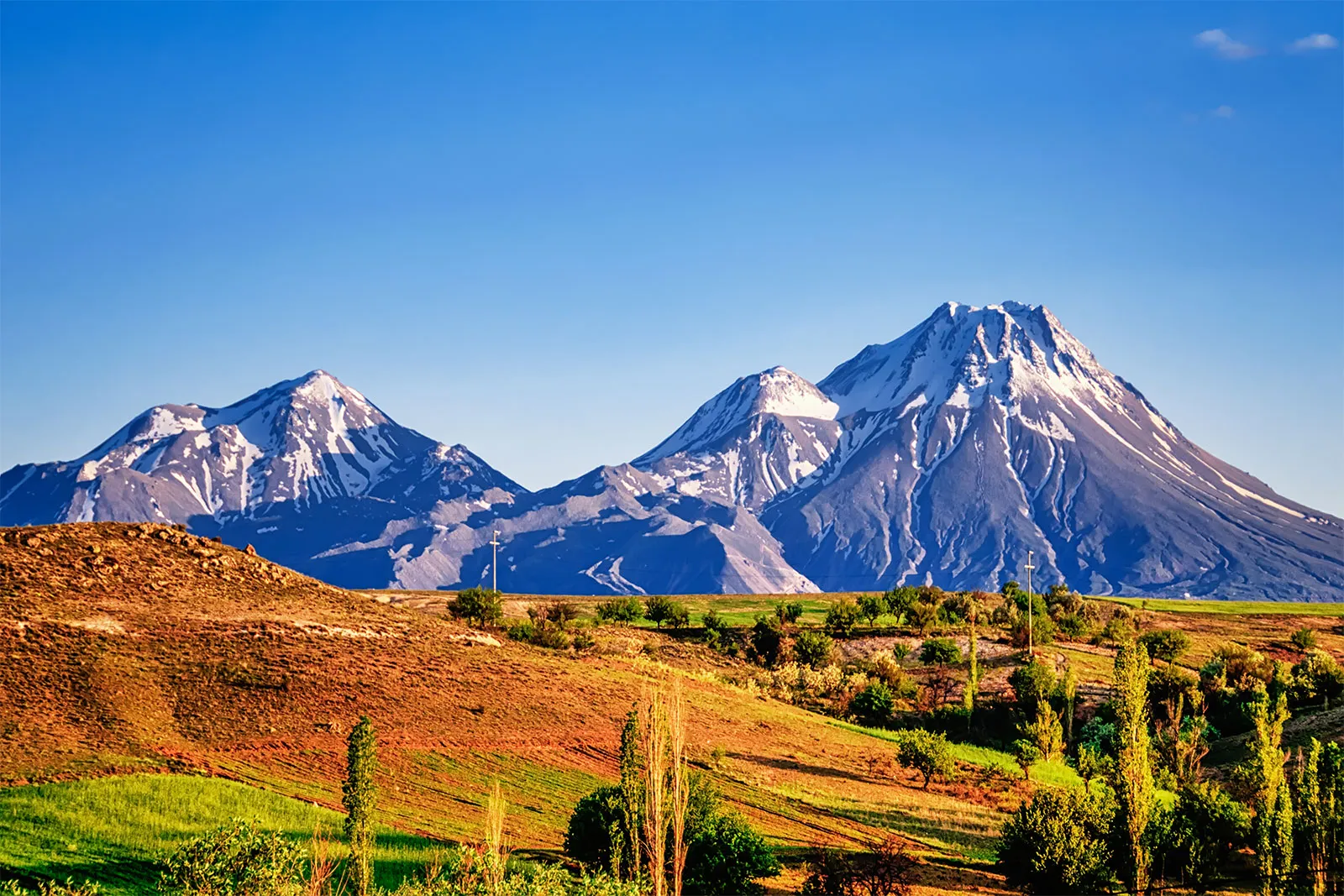
TAURUS MOUNTAIN
Taurus Mountains, mountain range in southern Turkey, a great chain running parallel to the Mediterranean coast. The system extends along a curve from Lake Egridir in the west to the upper reaches of the Euphrates River in the east. Aladağ (10,935 feet [3,333 metres]) in the Taurus proper and Mount Erciyes in the outlying offshoot of the Nur Mountains are the highest peaks; many other peaks reach between 10,000 and 12,000 feet (3,000–3,700 metres).
Scattered forests of pine, cedar, oak, and juniper are found on the slopes up to 8,000 feet (2,500 metres). White limestone ridges are common, and in the western Taurus are many enclosed basins with lakes at elevations averaging 3,200 feet (1,000 metres). Except for the large areas of deep-soiled fertile lands in the Cilician Plain below Adana, the coastal plains to the south are small, and the entire region is thinly populated and isolated from the interior by mountain barriers. Of the passageways crossing the mountains, the Cilician Gates (Külek Boğazı) is the most famous, having been used by caravans and armies since antiquity. Nearby is the only railway line that crosses the Taurus proper, joining Kayseri with Adana. Mineral deposits, partly exploited, include silver, copper, lignite, zinc, iron, and arsenic.


No comments:
Post a Comment